


VTD-Castlewood precinct, Hamlin County, South Dakota
About
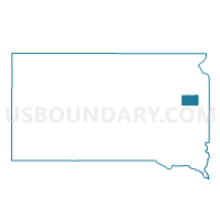
Outline

Summary
| Unique Area Identifier | 667338 |
| Name | VTD-Castlewood precinct |
| County | Hamlin County |
| State | South Dakota |
| Area (square miles) | 143.50 |
| Land Area (square miles) | 141.40 |
| Water Area (square miles) | 2.10 |
| % of Land Area | 98.54 |
| % of Water Area | 1.46 |
| Latitude of the Internal Point | 44.71524400 |
| Longtitude of the Internal Point | -97.00370840 |
Maps


Graphs
Select a template below for downloading or customizing gragh for VTD-Castlewood precinct, Hamlin County, South Dakota


Neighbors
Neighoring Voting District (by Name) Neighboring Voting District on the Map
- VTD Estelline precinct, Hamlin County, SD
- VTD Hayti precinct, Hamlin County, SD
- VTD Norden precinct, Hamlin County, SD
- VTD precinct 7, Deuel County, SD
- VTD precinct Kranzburg, Codington County, SD
- VTD precinct Sheridan, Codington County, SD
- VTD-Oxford precinct, Hamlin County, SD
- VTD-precinct 11, Deuel County, SD
- VTD-precinct 9, Deuel County, SD
Top 10 Neighboring County Subdivision (by Population) Neighboring County Subdivision on the Map
- Castlewood city, Hamlin County, SD (627)
- Norden township, Hamlin County, SD (511)
- Sheridan township, Codington County, SD (433)
- Kranzburg township, Codington County, SD (351)
- Oxford township, Hamlin County, SD (332)
- Estelline township, Hamlin County, SD (324)
- Hayti township, Hamlin County, SD (279)
- Dempster township, Hamlin County, SD (257)
- Hamlin township, Hamlin County, SD (233)
- Castlewood township, Hamlin County, SD (226)
Top 10 Neighboring Place (by Population) Neighboring Place on the Map
Top 10 Neighboring Unified School District (by Population) Neighboring Unified School District on the Map
- Watertown School District 14-4, SD (25,013)
- Deuel School District 19-4, SD (3,327)
- Hamlin School District 28-3, SD (3,314)
- Estelline School District 28-2, SD (1,589)
- Castlewood School District 28-1, SD (1,394)
- Waverly School District 14-5, SD (1,058)
Top 10 Neighboring State Legislative District Lower Chamber (by Population) Neighboring State Legislative District Lower Chamber on the Map
- State House District 5, SD (23,721)
- State House District 4, SD (20,558)
- State House District 6, SD (19,896)
Top 10 Neighboring State Legislative District Upper Chamber (by Population) Neighboring State Legislative District Upper Chamber on the Map
- State Senate District 5, SD (23,721)
- State Senate District 4, SD (20,558)
- State Senate District 6, SD (19,896)
Top 10 Neighboring 111th Congressional District (by Population) Neighboring 111th Congressional District on the Map
Top 10 Neighboring Census Tract (by Population) Neighboring Census Tract on the Map
- Census Tract 9541, Codington County, SD (3,198)
- Census Tract 9552, Hamlin County, SD (3,151)
- Census Tract 9536, Deuel County, SD (2,924)
- Census Tract 9551, Hamlin County, SD (2,752)
Top 10 Neighboring 5-Digit ZIP Code Tabulation Area (by Population) Neighboring 5-Digit ZIP Code Tabulation Area on the Map
- 57201, SD (24,983)
- 57226, SD (2,072)
- 57223, SD (1,356)
- 57234, SD (1,274)
- 57248, SD (1,057)
- 57241, SD (1,048)
- 57238, SD (483)